

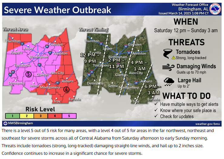
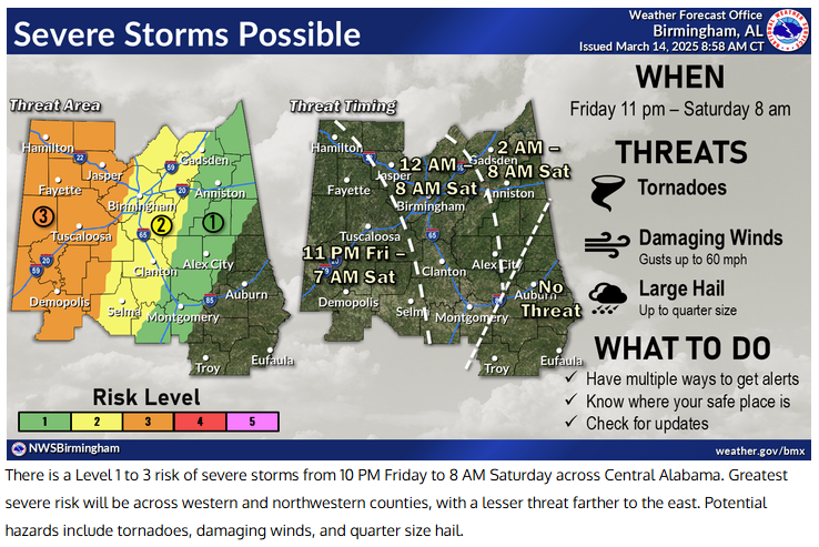
A significant severe weather event is expected to impact Pell City beginning the evening of Friday, March 14, and lasting through the day on Saturday, March 15. The National Weather Service Birmingham anticipates widespread thunderstorms producing large hail, damaging winds, and tornadoes.
STORM SHELTERS
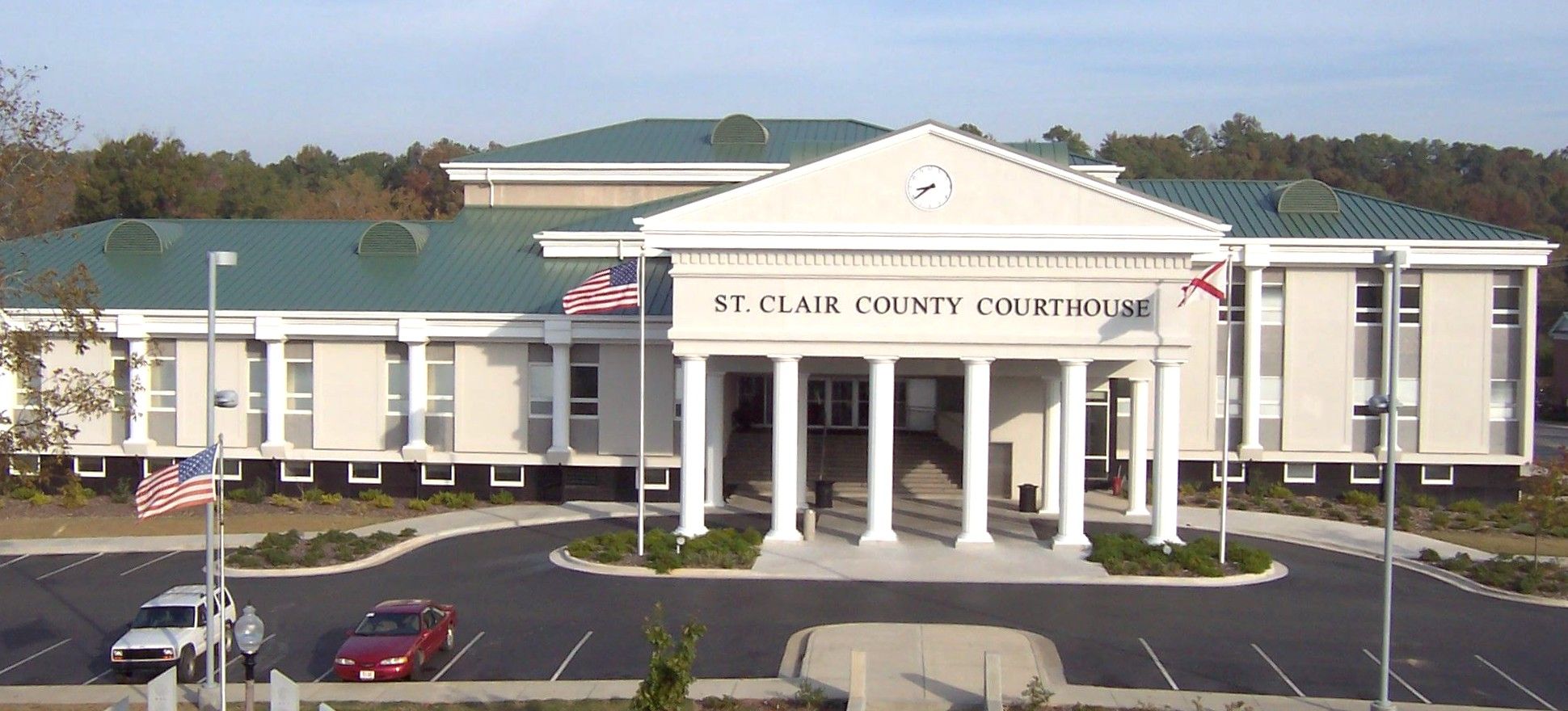
Two storm shelters in Pell City will be open to the public – the St. Clair County Courthouse and the Center for Education and Performing Arts. Shelters will open when a tornado watch is issued for our area. The CEPA Shelter, which is located on the north side of the building, will be open all day on Saturday, March 15, beginning at 8 a.m.
Storm Shelter: St. Clair County Courthouse
Storm Shelter: Pell City Center for Education and Performing Arts (CEPA)

Only registered service animals are permitted in the CEPA shelter.
Real-Time Weather Updates
- National Weather Service Birmingham: https://forecast.weather.gov/MapClick.php?lat=33.6117763&lon=-86.2903913
- ABC 33/40 Weather: https://abc3340.com/weather
- Fox 6 Weather: https://www.wbrc.com/weather/
- NBC 13 Weather: https://www.wvtm13.com/weather
- CBS 42 Weather: https://www.cbs42.com/weather/
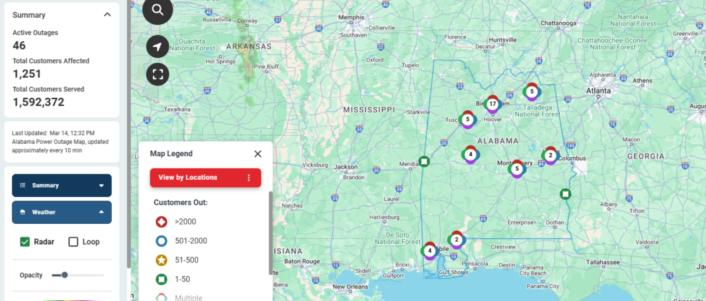
Alabama Power
Outage Map: https://outagemap.alabamapower.com
Timeline of First Round of Severe Weather
- Friday, 3/14 4 PM: Scattered showers develop over Louisiana and Arkansas
- Friday, 3/14 10 PM: Scattered showers move east of the Mississippi River and develop into scattered severe thunderstorms.
- Saturday, 3/15 2 AM: Severe thunderstorms move into Alabama and central Tennessee.
- Saturday, 3/15 4 AM: Severe thunderstorms are expected to move into central Alabama.
- Saturday, 3/15 5 AM: Widespread severe weather moves into central and eastern Alabama.
Timeline of Second Round of Severe Weather
- Saturday, 3/15 7 AM: Scattered severe thunderstorms are expected to be ongoing across Louisiana, Mississippi, Alabama, and Tennessee. A line of severe thunderstorms will develop across far western Louisiana.
- Saturday, 3/15 12 PM: The line of severe thunderstorms will move east of the Mississippi River with conditions clearing out to the west. Scattered severe weather will continue east of the line.
- Saturday, 3/15 5 PM: The line of severe thunderstorms crosses into Alabama and central Tennessee.
- Saturday, 3/15 10 PM: The line of severe thunderstorms crosses into Georgia and eastern Tennessee.
Preparation is key
From the National Weather Service Birmingham: The links below will help you find out what you can do now to prepare for a tornado. Preparation is key to staying safe and minimizing impacts.
Be Weather-Ready: Check the forecast regularly to see if you’re at risk for tornadoes. Listen to local news or a NOAA Weather Radio to stay informed about tornado watches and warnings. Check the Weather-Ready Nation for tips.
Sign Up for Notifications: Know how your community sends warnings. Some communities have outdoor sirens. Others depend on media and smart phones to alert residents of severe storms capable of producing tornadoes.
Create a Communications Plan: Have a family plan that includes an emergency meeting place and related information. If you live in a mobile home or home without a basement, identify a nearby safe building you can get too quickly, such as a church or family member.
Pick a safe room in your home, such as a basement, storm cellar, or an interior room on the lowest floor with no windows. Check more ideas for your family plan at: https://www.ready.gov/make-a-plan
Practice Your Plan: Conduct a family severe thunderstorm drill regularly so everyone knows what to do if a tornado is approaching. Make sure all members of your family know to go there when tornado warnings are issued. Don’t forget pets if time allows.
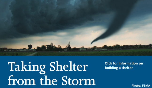
Prepare Your Home: Consider having your safe room reinforced. You can find plans for reinforcing an interior room to provide better protection on the Federal Emergency Management Agency website.
Help Your Neighbor: Encourage your loved ones to prepare for the possibility of tornadoes. Take CPR training so you can help if someone is hurt.